
Stream gauge monitoring
Stream gauges indicate water levels and serve as an indicator of drought or flooding. Understanding gauge information will be an important tool with increasing fluctuations in weather patterns.
Emergency management and services personnel, as well as citizens, can access daily water level readings from the following websites.
United States Geological Survey (USGS) National Water Dashboard:
The gages in the surrounding streams can provide important data relating to residents and the safety of their homes. Use this interactive map to learn more about discharge, turbidity, and more.
The USGS Mobile Water Data site highlights USGS current conditions water data in a mobile-friendly website, allowing users to monitor conditions at a favorite river or stream or locate nearby monitoring locations.
Use the links below for information on stream gage locations relevant to Town of Hurley residents.
National Weather Service Advanced Hydrologic Prediction Service:
The Advanced Hydrologic Prediction Service provided by the National Weather Service is a helpful tool to evaluate current stream conditions. The page titled, “Probability information” has several tools to predict short term (1-10 days) flood risks.
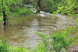
Note that your local conditions may vary considerably from stream conditions at Cold Brook.
Ask neighbors and town officials for information on past flood history at your location. Another strategy is to monitor the gage height in a variety of conditions and relate that measurement to visual observations of your local stream. How does the stream look after a few days of consistent rain? How does the stream look after weeks of no rain followed by a large rain event? Relating your visual observations to gage height measurement leads to a better understanding of how local streams respond to rain events.