Flooding

With increased oceanic and atmospheric temperatures, it is likely that residents will encounter increased precipitation, heatwaves, and substantial likelihood of extreme flood events. All residents should be aware of risks and know how to find information and help when flooding occurs. Whether you live in the flood zone or not, being prepared for an emergency is important. Visit this checklist to find important information before you take steps to repair your flooded home.
To learn more about preparation for a flood and other protective actions, visit FEMA.gov.
The Ashokan Watershed Stream Management Program (AWSMP) has their own Flood Emergency Preparedness fact sheet to help local residents learn more about floods and how to best prepare.
Flood Risk:
Visit FEMA's Flood Map Service Center to know types of flood risk in your area. The Emergency Alert System (EAS) and National Oceanic and Atmospheric Administration (NOAA) Weather Radio also provide emergency alerts.
View your location relative to flood zones on maps published by FEMA. Enter your address in the Ulster County Parcel Viewer and under the heading ‘Map Layers – Water Resources’ click the button for ‘FEMA Adopted Flood Hazards.’ The map identifies different flood zones that indicate the probability a flood will occur within the zone in any given year. Zone AE is called the ‘100-year flood zone’ because this zone has at least a 1% chance of being inundated by floodwaters in any given year. While that may not sound like much risk, this rarer and deeper flood has a 26% chance of occurring over the life of your 30-year mortgage. Structures within this zone may also be at risk during shallower and more frequent floods.
Flood Insurance:
Homeowner’s insurance policies do NOT cover flooding. It is recommended that residents in flood-prone areas purchase or renew a flood insurance policy. Policies typically go into effect 30 days after purchase. Get flood coverage under the National Flood Insurance Program (NFIP).
For information and resources related to repairing your flooded home, visit Health.ny.gov.
Post-Flood Resources:
MyCoast NY is a statewide portal used to collect and analyze photos of flooding, storm damage, and coastal change. When a photo report is submitted, it is automatically linked to data from the closest weather, river, and tidal or lake gauge to help provide context to the photo and is then posted to the website for anyone to see. Photo reports can be submitted through the app (iPhone / Android) or the website with a registered account. The three photo report types are:
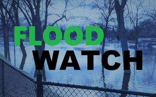
- Flood Watch: Tracking flooding across the state. This includes inland and coastal flooding.
- Storm Reporter: Documenting storm damage across the state.
- Coast Snap: Capturing the changing shoreline- currently at three locations.
Use MyCoast as a repository for photos of flood and storm impacts that can help raise awareness, build political will, inform municipal planning and emergency management, and complement other data and mapping. MyCoast brings together community members, local officials, state agencies, researchers, and NGOs in sharing and using the information.
To learn more about MyCoast NY, contact Jessica Kuonen at jak546@cornell.edu.
