
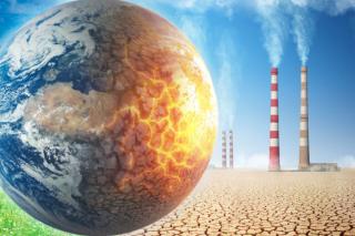
Climate change
How do we know we are experiencing climate change? Click here for the facts and to learn what the causes are.
- More information about how climate change affects NYS.
- Learn more about the specific effects of climate change throughout the regions of the state by visiting this fact sheet.
- What are some solutions to climate change?
Climate Change in the Hudson Valley and Catskills
Climate change has had and will continue to have various impacts on the Hudson Valley and Catskills regions. Here are some of the observed and projected changes.
- Temperature: The regions have experienced rising temperatures over the past few decades, and this trend is expected to continue. Winters are becoming milder, while summers are becoming hotter. Heatwaves are projected to increase in frequency and intensity, potentially affecting human health, agriculture, and energy demand.
- Precipitation: Changes in precipitation patterns have been observed, with more intense rainfall events and increased risk of flooding. These changes can lead to soil erosion, damage to infrastructure, and disruptions to agriculture. In contrast, periods of drought may become more common, impacting water resources and agricultural productivity.
- Sea Level Rise: The Hudson Valley is vulnerable to the impacts of sea-level rise due to its proximity to the Atlantic Ocean. Rising sea levels can increase the risk of storm surge and coastal flooding, affecting communities along the Hudson River and its estuary. Low-lying areas may experience saltwater intrusion into freshwater sources.
- Extreme Weather Events: Climate change is associated with an increased frequency and intensity of extreme weather events such as hurricanes, heavy storms, and snowstorms. These events can lead to property damage, power outages, and disruptions to transportation and daily life.
- Ecological Changes: Climate change can alter the distribution and composition of ecosystems in the Hudson Valley and Catskills. Species may shift their ranges or face challenges adapting to changing conditions, leading to potential disruptions in local biodiversity and ecological interactions.
Resources:
- Climate Projections for the Hudson Valley- Cornell CALS
- Cornell Cooperative Extension Ulster County
- Climate Change in the Hudson Valley- DEC fact sheet
Invasive Species and Climate Change
Invasive species and climate change are two major global environmental issues that are closely interconnected. Climate change can create new habitats or alter existing ones, which can make it easier for invasive species to establish and spread. In turn, invasive species can exacerbate the impacts of climate change by altering ecosystems, reducing biodiversity, and damaging infrastructure.
For example, as temperatures warm, some invasive species that were once confined to tropical or subtropical regions may be able to survive and spread into new areas. This can lead to a loss of biodiversity, as native species are outcompeted for resources. Invasive species can also alter ecosystems by changing the frequency and intensity of fires, reducing soil quality, and impacting water resources. Moreover, invasive species can also contribute to climate change by releasing large amounts of carbon into the atmosphere. For instance, the invasive plant species known as purple loosestrife can cause significant carbon emissions by outcompeting native vegetation and reducing carbon sequestration.
Invasive Species in the Hudson Valley and Catskills Regions:
The Hudson Valley and Catskills regions of New York are home to several invasive species, which can cause harm to native ecosystems and biodiversity, including:
- Japanese Knotweed: Japanese Knotweed is a tall, fast-growing plant that can quickly overtake native vegetation. It forms dense thickets that can block waterways and alter the ecosystem. It is prevalent in the Hudson Valley and Catskills regions, and its control and removal can be challenging.
- Emerald Ash Borer: The Emerald Ash Borer is a small, metallic green beetle that feeds on and kills ash trees. It is a significant threat to the ash tree population in the region, and efforts are underway to control its spread.
- Spotted Lanternfly: The Spotted Lanternfly is an invasive insect that feeds on the sap of plants, causing damage to fruit trees, grapevines, and hardwood trees. It was first detected in the region in 2020 and is considered a significant threat to agriculture.
- Mile-a-Minute Vine: The Mile-a-Minute Vine is a fast-growing, invasive vine that can smother native vegetation and alter the ecosystem. It has spiky stems covered in barbs that can make it difficult to control and remove.
- Zebra Mussel: Zebra Mussels are small, freshwater mollusks that can attach to and damage water infrastructure, boats, and other structures. They can also outcompete native species for resources and alter the ecosystem. They were first detected in the region in the early 2000s and have since spread to several waterways in the Hudson Valley and Catskills regions.
Efforts are underway to control and prevent the spread of these and other invasive species in the region. Community members can help by learning to identify invasive species, reporting sightings to local authorities, and taking steps to prevent the introduction and spread of invasive species, such as cleaning boats and equipment before entering waterways.
Resources:
- New York Invasive Species Information: This website provides comprehensive information about invasive species in New York, including identification, management, and prevention strategies. It also offers a variety of educational resources, such as videos, posters, and fact sheets.
- New York State Department of Environmental Conservation (DEC): The DEC is responsible for managing and protecting New York's natural resources, including invasive species. Their website offers a wealth of information about invasive species, including an identification guide, a list of prohibited and regulated species, and information about management and control.
- NY iMapInvasives: This is an online mapping tool that allows users to report and track invasive species sightings. It is a collaborative effort between government agencies, non-profit organizations, and citizen scientists, and is designed to help identify and manage invasive species populations. Community members can use the tool to report invasive species sightings in their area and contribute to the overall effort to combat invasive species in New York.
- New York Natural Heritage Program (NYNHP): NYNHP works to facilitate the conservation of New York’s biodiversity by providing comprehensive information and scientific expertise on rare species and natural ecosystems to resource managers and other conservation partners.
- Catskill Regional Invasive Species Partnership (CRISP): CRISP promotes education, prevention, early detection and control of invasive species to limit their impact on the ecosystems and economies of the Catskills.
- Lower Hudson Partnership for Regional Invasive Species Management (LHPRISM): The Lower Hudson PRISM works to protect the biodiversity and ecosystem services of the nine counties and boroughs which make up the Lower Hudson region through a collaborative and integrated approach to invasive species management.
Harmful Algal Blooms
Harmful Algal Blooms (HABs) are a serious environmental issue in New York, particularly in the summer months when temperatures are warm and water levels are low. HABs are caused by an overgrowth of cyanobacteria, also known as blue-green algae, which can produce toxins harmful to humans and animals.
HABs can occur in both freshwater and marine environments and can be triggered by a variety of factors, including warm water temperatures, excessive nutrients from sources such as agricultural and urban runoff, and changes in water chemistry. In the Hudson Valley and Catskills regions, HABs are often associated with nutrient pollution from agricultural runoff and sewage discharge, which can contribute to the growth of cyanobacteria.
HABs can have serious impacts on human and animal health. The toxins produced by cyanobacteria can cause a range of symptoms, including skin irritation, nausea, vomiting, diarrhea, and even liver damage. In some cases, exposure to HABs can be fatal for pets and wildlife.
To address the issue of HABs in the Hudson Valley and Catskills regions, efforts are underway to reduce nutrient pollution, improve water quality monitoring and reporting, and develop early warning systems to alert the public to potential HAB outbreaks. Community members can also take steps to help prevent HABs by reducing their use of fertilizers and other sources of nutrient pollution and reporting suspected HABs to local authorities.
Resources:
- New York State Department of Environmental Conservation (DEC): The NYS DEC provides information on harmful algae blooms across the state. Their website includes updates on current blooms, health advisories, and information on how to report a bloom.
- New York State Department of Health (DOH): The DOH oversees the health, safety, and well-being of New Yorkers by utilizing new developments in science as critical tools in the prevention and treatment of infectious diseases.
- The New York State Federation of Lake Associations (NYS FOLA): NYSFOLA is a not-for-profit coalition of lake associations, individuals, and corporate members dedicated to the protection and restoration of New York lakes.
- Hudson River Watershed Alliance: The Hudson River Watershed Alliance is a network of organizations and individuals working to protect the Hudson River and its watershed. Their website includes information on harmful algae blooms, including resources for prevention and management.
- The United State Environmental Protection Agency (EPA): The mission of EPA is to protect human health and the environment by providing accurate scientific information.
Flooding
With increased oceanic and atmospheric temperatures, it is likely that residents will encounter increased precipitation, heatwaves, and substantial likelihood of extreme flood events. All residents should be aware of risks and know how to find information and help when flooding occurs. Whether you live in the flood zone or not, being prepared for an emergency is important. Visit this checklist to find important information before you take steps to repair your flooded home.
To learn more about preparation for a flood and other protective actions, visit FEMA.gov.
The Ashokan Watershed Stream Management Program (AWSMP) has their own Flood Emergency Preparedness fact sheet to help local residents learn more about floods and how to best prepare.
Flood Risk:
Visit FEMA's Flood Map Service Center to know types of flood risk in your area. The Emergency Alert System (EAS) and National Oceanic and Atmospheric Administration (NOAA) Weather Radio also provide emergency alerts.
View your location relative to flood zones on maps published by FEMA. Enter your address in the Ulster County Parcel Viewer and under the heading ‘Map Layers – Water Resources’ click the button for ‘FEMA Adopted Flood Hazards.’ The map identifies different flood zones that indicate the probability a flood will occur within the zone in any given year. Zone AE is called the ‘100-year flood zone’ because this zone has at least a 1% chance of being inundated by floodwaters in any given year. While that may not sound like much risk, this rarer and deeper flood has a 26% chance of occurring over the life of your 30-year mortgage. Structures within this zone may also be at risk during shallower and more frequent floods.
Flood Insurance:
Homeowner’s insurance policies do NOT cover flooding. It is recommended that residents in flood-prone areas purchase or renew a flood insurance policy. Policies typically go into effect 30 days after purchase. Get flood coverage under the National Flood Insurance Program (NFIP).
For information and resources related to repairing your flooded home, visit Health.ny.gov.
Post-Flood Resources:
MyCoast NY is a statewide portal used to collect and analyze photos of flooding, storm damage, and coastal change. When a photo report is submitted, it is automatically linked to data from the closest weather, river, and tidal or lake gauge to help provide context to the photo and is then posted to the website for anyone to see. Photo reports can be submitted through the app (iPhone / Android) or the website with a registered account. The three photo report types are:
- Flood Watch: Tracking flooding across the state. This includes inland and coastal flooding.
- Storm Reporter: Documenting storm damage across the state.
- Coast Snap: Capturing the changing shoreline- currently at three locations.
Use MyCoast as a repository for photos of flood and storm impacts that can help raise awareness, build political will, inform municipal planning and emergency management, and complement other data and mapping. MyCoast brings together community members, local officials, state agencies, researchers, and NGOs in sharing and using the information.
To learn more about MyCoast NY, contact Jessica Kuonen at jak546@cornell.edu.
How Can I Help?
Reducing greenhouse gas emissions is crucial for mitigating climate change. To learn more about mitigation and adaptation strategies in response to climate change, visit NASA. Here are some strategies to achieve this through energy efficiency, renewable energy adoption, sustainable transportation choices, and waste reduction practices.
- Energy Efficiency:
- Improve insulation and weatherization of homes and buildings to reduce energy consumption. Learn more: Energy.gov - Energy Efficiency Upgrades
- Upgrade to energy-efficient appliances, lighting, and HVAC systems. Explore: ENERGY STAR.
- Receive no-cost energy advising and assistance with accessing NYS energy efficiency assistance programs through CCE Smart Energy Choices - MidHudson.
- Renewable Energy Adoption:
- Install solar panels on rooftops to generate clean, renewable electricity. Discover: New York State Energy and Research Development Authority (NYSERDA).
- Consider joining community solar projects to access renewable energy even if you can't install panels at your location. Find out more: New York State Energy and Research Development Authority (NYSERDA).
- Sustainable Transportation Choices:
- Consider purchasing an electric vehicle (EV) or hybrid vehicle to reduce emissions from transportation. Find out more: New York State Energy and Research Development Authority (NYSERDA).
- Waste Reduction Practices:
- Practice recycling and composting to minimize waste sent to landfills. Find recycling facilities near you:
- Reduce single-use items by opting for reusable alternatives like water bottles, shopping bags, and food containers. Learn more: U.S. Environmental Protection Agency - Reduce, Reuse, Recycle.
These strategies, when adopted by individuals and communities, can significantly contribute to reducing greenhouse gas emissions. For more information and resources on reducing emissions and sustainable practices, you can refer to organizations such as the Environmental Protection Agency (EPA), U.S. Department of Energy (DOE), and Sustainable America.
Get Involved
Recognizing the negative effects of climate change is the first step in making a change. If you would like to learn more about how you can get involved in adaptation and resiliency projects related to climate change, sign up for the Town of Hurley Climate Smart Task Force newsletters or visit the Climate Smart Facebook.
You can also visit the Environmental Protection Agency’s (EPA) webpage for more information on what you can do to help.
This project was made possible by a program of Cornell Cooperative Extension Ulster County in partnership with the NYS DEC Hudson River Estuary Program, NY Water Resources Institute and Cornell University with support from the NYS Environmental Protection Fund. For more information, visit the Climate Resilience Partnership (CRP) webpage.
| Attachment | Size |
|---|---|
| 145.94 KB |